Beneath the surface of every thriving city lies an unseen network of veins and arteries—water, sewer, gas, electric, and communication cables—that feed life as it is experienced from day to day. But for decades, infrastructure crews have wrestled with disconnected spreadsheets, paper maps, and stovepipe databases, leading to costly delays, safety risks, and surprise outages.
Welcome geoAMS: a modern, cloud-based asset management tool that brings these subsurface mysteries alive as a living, breathing data map. From initial installation, geoAMS documents its precise location on a hyper-realistic GIS backdrop, notes in manufacturer information, and dates its first entry. Years pass and networks expand, but every inspection comment, maintenance history, and condition rating feeds back into one unified digital record—guesswork and blind spots no more.
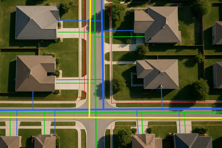
Consider the case of a midsize utility district that was flooded with reactive maintenance. Staff fought to respond to customer-reported leaks, finding themselves facing chaotic record-keeping, lost manholes, and patchwork drawings that didn’t reflect the condition. After installing geoAMS, they imported thousands of available records and overlaid them on easy-to-use, color-coded maps: blue lines for water mains, purple for sewer alignments (with mapped manholes), yellow for electric conduits, red for gas pipelines, and green for fiber communications. In weeks, scheduled maintenance replaced emergency repairs, cutting response times 40% and saving millions in costly repairs.
That’s only half of it. Today’s sites include a range of custom assets—fences, benches, signs—and geoAMS’s flexible data model supports them. You’re dealing with a public park, university campus, or industrial site, and you add new asset classes, assign properties like material or condition rating, and collocate them with standard network elements. Field technicians use mobile GIS to report in the field in real-time; engineers export detailed reports to utilize within grant applications and regulatory filings; executives monitor portfolio health and capital budgets from dynamic dashboards.
This unification doesn’t just streamline processes—it fosters teamwork, accountability, and strategic insight. Imagine planning a major pipeline upgrade with absolute confidence in your data: you can say you exactly which sections are at end-of-life, which valves have been serviced recently, and where growth down the line will produce the greatest ROI. That clarity makes planning sessions into forward-looking strategy sessions, not last-ditch firefighting.
Is your organization ready to leave the era of manual asset tracking behind? Discover how geoAMS brings every pipe, conduit, and connection into a single pane of glass—reducing emergency repairs, accelerating project timelines, and ensuring compliance with audit-ready records.
Sign up now for a **14-day free trial** and experience the future of geospatial asset management for yourself.
Sign up now for a **14-day free trial** and experience the future of geospatial asset management for yourself.
This website uses cookies. By continuing here, you agree to the use of cookies.